
GeoSmart Information, a leading UK flood data and analytics specialist, has released new data following a decade of development, which reveals the full risk of flooding in Great Britain and shows the complex role of groundwater in context for the first time.
GeoSmart’s ground-breaking analytics tool is the first to model all main sources of flooding, crucially now including groundwater, on a consistent national basis. Despite being responsible for about £200 million in flood losses annually – more than the annual losses from tidal flooding – the hidden risk of groundwater has been little understood until now.
Using its flood modelling tool FloodSmart Analytics, GeoSmart is able to provide detailed risk analysis of individual properties across Great Britain and estimates average annual damage from flooding totals around £1.5 billion.
The model shows that groundwater flooding threatens about 5% of all homes in Great Britain, located in groundwater hotspots including Lincolnshire, Yorkshire, Hampshire, Dorset, Wiltshire, Oxfordshire, Kent, Surrey, London, and elsewhere (a similar number to those threatened by river flooding).
Groundwater also drives risk from flash flooding and rivers in ways that increase those risks in certain locations. The GeoSmart analysis provides the necessary insight to improve flood risk management both related to baseline risk and also climate change, with climate change data due for release shortly.
Dr Paul Ellis, managing director of GeoSmart Information, said:
“It’s clear that the risk from groundwater flooding has been significantly underestimated or mis-reported until now, leaving risk managers with inadequate data to properly manage the risks and preventable damage to millions of homes across the UK.
“With these findings – which are the results of 10 years of research and development – homeowners and insurers can now see the risk from all sources of flooding, including groundwater, at high resolution down to individual property level, which will help them to prevent, mitigate, and guard against the risks far more effectively.
“We have also brought a better understanding of risk factors affecting sewers and basements and shown how catchments respond differently depending on groundwater conditions. Notably the GeoSmart Groundwater Forecast is predicting very high groundwater levels for the winter ahead and this is currently increasing river flooding likelihood in some parts of the country. Once you can see the role of groundwater driving increased risk from rivers and flash flooding, you are in a much better position to manage these risks.”
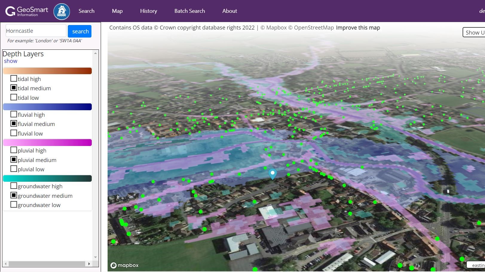
Before GeoSmart’s analysis, there have been no reliable national maps of the real risk of groundwater flooding within the context of overall flood risk. This new data, combining all sources of flooding, can now be accessed through automated reports, national licensing, or via an API or web portal.
Phillip Martin, director of risk at GeoSmart, said:
“Integrating groundwater consistently into flood modelling provides a much clearer and more accurate picture of risk, and explains the contribution from each mechanism at property level – something that will be welcomed by insurers, homeowners, and business owners alike. This could be a huge milestone in the development of more effective flood risk management strategies, since almost two in five residential properties are at risk from flooding in Great Britain, which increases to almost half of commercial properties.”
Dr Ellis added: “Groundwater forms an important piece of the flooding jigsaw. It is harder to mitigate against and can emerge from underneath flood defence walls. It also tends to persist for longer periods, leading to increased disruption to building occupants and higher losses for insurers.
“Saturated ground also increases the likelihood of flash flooding and fluvial flooding. Mis-categorisation of these risks has led to poor risk management, which this new data helps to overcome.”

