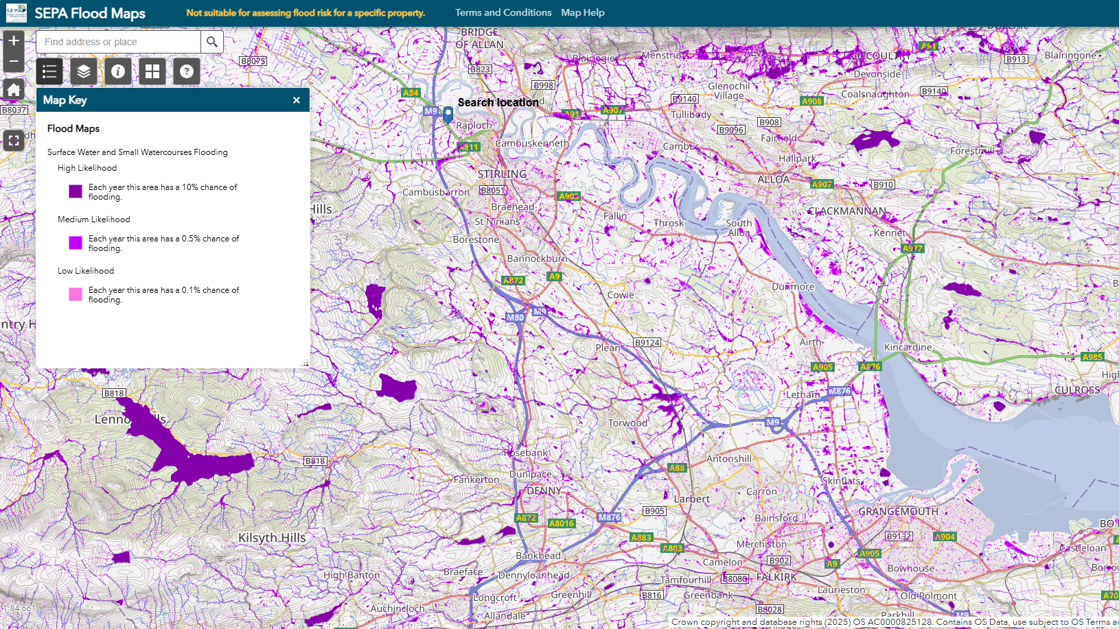
The Scottish Environment Protection Agency (SEPA) has unveiled new surface water flood maps, which for the first time include small watercourses. This new level of detail provides Scotland with the most detailed and accurate picture of where flooding could occur from heavy rainfall.
Flooding is Scotland’s biggest climate adaption challenge, and these maps mark a major step forward in helping communities and businesses understand the flood risk in an area, and what the impacts could be when surface water flooding happens, to help protect lives, properties and communities.
The maps, developed with JBA Consulting, provide comprehensive coverage across Scotland, with the most accurate detail to date, utilising the latest science, data and information on climate change. By integrating the latest rainfall data and climate change projections they reflect more accurately the areas likely to be affected by surface water during heavy rainfall. SEPA has also worked collaboratively with local authorities and other partners to incorporate local knowledge throughout the production and review of the maps.
Vincent Fitzsimons, Head of Hydrology and Flooding Services, SEPA said:
“Surface water flooding is Scotland’s most widespread flood risk, and climate change is making it more severe. These new maps are a game-changer in how we understand and prepare for flooding both now and in the future. Our enhanced, data-driven and collaborative approach ensures that flood risk is clearly understood, enabling proactive measures that help safeguard lives, property and builds community resilience.
“Protecting Scotland’s communities is at the heart of what we do at SEPA. These updated flood maps are a significant step forward in our ongoing efforts to provide individuals, businesses, and local authorities clearer, more detailed, and more accurate information about where flooding could occur which allows them to prepare for and respond when flooding happens.”
People and communities suffer the most during floods, and the effects can be severe and last a long time for those who have been impacted. Surface water remains the biggest risk of flooding in Scotland and can affect anyone. Understanding how you can be affected by flooding is the first step in being prepared. The new surface water and small watercourses flood maps can be accessed on SEPA’s website, where users can also find out how they may be exposed to flooding from rivers and the sea.


